[The story so far....a couple from Teddington, UK, move in 2012 to the Falkland Islands. While one goes off to work each day, the other keeps a lookout for penguins and explores / keeps fit by Nordic Walking. Now read on.........]
 |
| Long-tailed Meadowlark... or Falklands Robin |
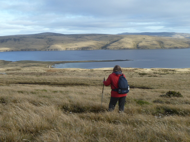
Autumn was marching on, and Winter was fast approaching. (I understand our recent weather has been similar to Spring in the UK, only a lot drier! Another difference from the northern hemisphere, is that what few leaves we have don't change colour). Before our travelling around was restricted by poor weather or roads, we wanted to see a different bit of the Falklands. So we booked a weekend in a cottage on Race Point Farm, at the western coast of East Falklands, about 50 miles west of Stanley.
On the 21,000 acre farm is one of the beaches which was used for the landings during the Falklands War. So, my interest in the conflict was piqued - what had it been like to have 500 paratroopers dug in round your house, and your tiny airstrip to be the main land base for a squadron of Sea Harriers? Also, on the beaches, were reported to be several species of penguin. Would they still be there?
We set off across Camp, passing the western side of Two Sisters - the hill we had recently climbed (see the recent post, "Two Sisters - Twin Peaks").
 |
| Two Sisters from the west. Difficult walking, even in daylight. |
It looked a lot more challenging from this side. I don't think we'll be climbing it in the dark with people shooting at us, but we'll try to walk to the western summit soon. The officer who led the attack on Two Sisters, Mike Cole, is soon to be recreating the 75km "Yomp" across the Falklands and is giving a talk in Stanley about it this month. He is hoping to raise money for charities which help ex-servicemen. One of my neighbours, Trev Law, is joining him in the march. For more details on the walk and the charity, please visit the Justgiving site -
JustGiving site for Yomp 2012
 |
| North Camp road crossing an inlet. |
Unlike the Commandos and paratroopers, we crossed the 75km of wide open countryside in comfort, passing about 4 farms, and about the same number of cars, in the two and a bit hours it took to drive to Port San Carlos.
 |
| North over Malo Hill. |
The farm was located at the mouth of the San Carlos River, as it enters San Carlos Water, a fiord off Falklands Sound - the strait that separates East and West Falklands. It was this sheltered inlet that was chosen as the best place to land British forces in 1982.
 |
| Race Point Farm gate. Only 10 miles to the farmhouse! |
I had asked for directions from the owners, John and Michelle. "Follow the track until you get to the Big House with the red roof!" So, after coming to the Race Point Farm gate, we drove around a mountain for 10 miles and then came over a crest, and.....there it was: the Big House, and San Carlos Water!
 |
| Race Point Farm (red roof, centre). Dark green are trees, light green is gorse. |
 |
| The Big House |
 |
| No egg shortage here |
 |
| Turf wall protects gardens and trees |
After settling in to our cosy, refurbished cottage, we strolled out to catch the last sunshine of the day, as dusk was about 5.30pm. (The Falklands Islands' Government had recently abandoned the practice of "putting the clock back" in Autumn, much to the displeasure of many people, especially those in Camp and West Falklands, who, in any case, have "Camp Time", which is about an hour different from Stanley. In reality, though, most camp residents are farmers, and they work all daylight hours in the year, so changing the clock has little impact on them.. However, we had to clarify if "Breakfast is at 8", really meant at 7am!)
 |
| Sunset over San Carlos Water, and West Falklands' hills |
In our short stroll to the riverside, we went through a gap in the long gorse hedge (planted as a sheep shelter) and across a close-cropped grass field, which we learned later was also the farm's airstrip. The next morning, the owners showed us old photos on the Big House's walls which showed the airstrip with several dozen helicopters and a squadron of Sea Harriers around it (called HMS Sheathbill by the Fleet Air Arm. Photos of it can be found at the Imperial War Museum collection..... here >
http://www.iwm.org.uk/collections/item/object/205095933 . These planes were using the airstrip instead of an aircraft carrier far out in the South Atlantic. It must have shocked the chickens from their peaceful peckings!)
 |
| Must be good pasture.... |
As the sun came up, we observed some of the animal life around the farm - about 20 free-range hens; a dozen or so horses and ponies, 5 sheepdogs, and 3 hares which colonised the gorse hedge.
 |
| Horses and ponies everywhere |
The farm has one of the highest concentrations of livestock on the islands - about 1 sheep to about 4 acres, compared to 1 per 8 acres in land with poorer grazing. (In the UK, I think it is around 6 sheep per acre, but don't quote me!).
Another sign of good grazing and better pasture was dairy cattle. I recognised fellow-natives of the south-west of Scotland - the brown and white Ayrshires (my home county)....
 |
| Ayrshires! |
After some freshly-laid and freshly-cooked eggs, we felt the need for a long walk on a gloriously sunny and windless day. We headed west past the airfield, and noticed a tranquil corner where the previous owners had a private cemetery under some rare evergreen trees.
 |
| Rare trees at family cemetery. Gorse hedge |
A little further on were the still-visible trenches dug by 3 Para, who landed there on the 21st May 1982, and after securing the beachhead without opposition, started to "yomp" (or "tab" in the parlance) across the Falklands towards Stanley. They had virtually no vehicles that were suitable for the boggy terrain, and most of the troop-carrying helicopters had sunk to the bottom of the ocean when the Atlantic Conveyor was hit by an Exocet missile. So, walking was the only option....
 |
| Recently-harvested field of oats |
Carrying a flask and a packed lunch, rather than 100lbs of equipment like the Paras, we progressed along the shore, passing the only field of cereals - oats - that I'd seen since arriving in the Falklands. Good soil, indeed! I'd heard that oats had been grown in Scotland, not only because Scots love porridge, but because that was all that would grow in the climate! So, I surmised that the usual climate here was generally similar to parts of Scotland - damp, windy, and rarely too warm or too cold. No wonder the Ayrshire cattle looked content.
 |
| Fishing basket flotsam |
Eventually, the close-cropped grass gave way to the more usual native species of low ground plants and grasses. One of the nearby islands we passed could be reached at low tide and had obviously been used for grazing, as the high native tussac grass could be seen as only remaining on the inaccessible cliffs, and the rest of the island nibbled down to the turf.
 |
| Island showing impact of sheep grazing. Native tussac grass only remains on the cliff. |
Further along, two rather lonely Gentoo penguins were the only occupants of a beach that might have held several hundred a few weeks ago. Unlike other species on the farm, like Rockhopper, Gentoo penguins remain in the Falklands all year and don't head off to follow the food across the southern ocean. But most of them were probably out fishing in San Carlos Water today.
 |
| Gentoo penguins |
Maybe at another time of year, we would have continued along the coast to find the Rockhoppers, but we decided to gain the high ground to enjoy what promised to be some good views. (The following day, the weather was low cloud and fog, so we're glad we made that decision!)
 |
| Grass wren |
Climbing the grassy slopes to about 800 feet, past some beef cattle and wrens, we soon reached the watershed between Race Point and the neighbouring farm to the north.
 |
| Reaching the ridge |
To the west, lay San Carlos Water and the West Falklands. To the south, were views to the highest mountain, Usborne (about 2,300 feet), across undulating sheep farms as far as the eye could see.
 |
| Race Point Farm, Port San Carlos |
Nestling below us in its sheltered spot, was the Big House and farm buildings. Race Point farm is named after a tidal race that occurs around one of the many bends in the San Carlos River. Before a bridge was built about 12 miles upstream, people and livestock were rowed across the river near here, to head for the "neighbouring" settlement of San Carlos.
 |
| West to San Carlos Water |
I was also reading a book, set in the 1960s, about a travelling teacher, who visited the remote farms by horseback. Travelling teachers still perform these visits - staying for a couple of weeks with farming families before moving on to the next set of pupils. But nowadays, they are transported by Land Rover or quad bike across the countryside.
 |
| D-Day Green beach below |
When children reach secondary school age, they move to Stanley and board in town. It must be a wrench to leave behind the endless vistas, as well as pet ponies and lambs. Not to mention the penguins.
 |
| San Carlos River; Mt Usborne (in cloud) in distance; Land Rover tracks |
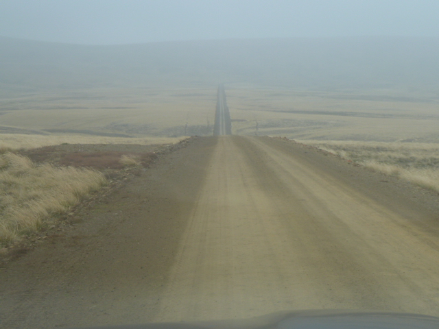
One thing we have realised about the weather in the Falklands, was that it is changeable. And true to form, the next day dawned, although we couldn't see out the cottage windows!
 |
| Freezing fog on the hills. Empty dirt roads |
After another large breakfast, we set off in the gloom. We had originally planned to arrive today, but what a different impression we would have taken home if we had not enjoyed the sunset and views!
 |
| Always useful to have someone to open gates in foul weather... |
We headed south for about 40 miles, over the Sussex Mountains, and then turned west when we met the Darwin road. This passed the Mount Pleasant airport and military base. Around here was a sign indicating we were now on land belonging to Fitzroy River Farm, and I glanced at the odometer. We crossed the Fitzroy River, which marks the eastern boundary of the farm, 17 miles later!
So, farms on the Falklands are more like sheep stations in the Australian Outback and we had only scratched the surface at Race Point. But, hopefully, we will return to explore some more.
Peter


How will you cope with London after all this space and far horizons?
ReplyDeleteBit like the Falklands secondary school age children being forced to board in town?
Yes, we have thought about that. It does get rather addictive - looking out at the weather systems rolling across the mountains.... Maybe we'll retire to the Shetlands? :-) Or St Kilda, and try to introduce some penguins...? (There used to be the flightless Great Auk in the north Atlantic but they were all shot by fishermen. Then Man found the penguins, and killed over a million in 3 years (19th century) in the Falklands alone - for their oil! )
DeleteAnother enjoyable and interesting piece Peter, thank you. I
ReplyDeletelike to see the birds and animals. Have you encountered
any Nordic walkers down there? Your poles are certainly
seeing plenty of action! Sue
Thanks, Sue. No Nordic Walkers as yet. I think they are waiting on me to get my act together and offer lessons!
DeleteYou need to change the name. Nordic walking is ok for the northern hemisphere, but in the south it needs to be Sudic?
Delete"Austral" might be better. Good point, though. Advert now submitted to Penguin News...
Delete