[Apologies to penguin lovers. Although we are now back in the Falklands, this chapter of our life in the Southern Hemisphere is set in Bolivia, which we recently visited. No penguins in Bolivia, but plenty of Vicuna and Viscacha. Not seen one? Read on....]
The title of this post is from the Bond film, "Quantum of Solace", which I borrowed from the well-stocked library in Stanley, after hearing some of it was set in Bolivia. Like James Bond, I knew very little about the country, so thought it would be interesting to see how it was portrayed. We've just returned from this fascinating and beautiful country......
 |
| Licancabur, border of Chile and Bolivia |
Well, the Atacama Desert features a lot in the Bond film, but as we had just experienced this huge wilderness, we knew that it was in Chile, not Bolivia! Maybe the location director needed some help?
 |
| Chilean/Bolivian border |
We had spent 4 days in the desert (See - To Mars & Beyond post), and the next leg of our trip began with a short taxi ride to the edge of San Pedro de Atacama; waiting in a long queue to have our passports stamped by Chilean Border police; and then onwards and upwards to the border on a very smooth, sealed, highway, the likes of which we were not to see again until we arrived back in Chile!

|
| The Chilean-Bolivian border (the snowy ditch), with the Bolivian border post on the other side. |
Within about 20 minutes, we were at the rather insubstantial border - a line in the sand (or snow). A 4x4 car arrived at the other side of a small ditch (the border) , and Ricardo and Noel introduced themselves as our driver and guide for the next stage of the trip. Bags and passengers were handed over, and we were told to go into the hut and have the Bolivian border guards approve our entry into the country.
 |
| Bolivians! With bottles of water for the effects of altitude. |
The Bolivian border control is in a tiny building at 13,000 feet (4000 metres) above sea level, in the middle of a barren plateau, surrounded by volcanoes. It was a lonely outpost compared to the bustling, cosmopolitan San Pedro we had just left, and it must have been an ordeal for the border guards living there.
Within minutes we were on our way, and spotting herds of vicuna loping across the plain. Vicuna are valued for their fine wool, and are related to the Llama, guanaco and alpaca. These camelids live at different levels in the mountains, each adapted to the different eco-systems that the altitude and tiny rainfall confer.
But apart from the odd vicuna, we saw very few signs of life that day.
The "road" was simply one of many parallel tracks ploughing across the gravel of the Altiplano. Whereas, on the Chilean side of the Andes, we climbed from about 9,000 feet to 13,000 in less than 30 minutes, it was going to take us 3 days of gradual descent to get back down to that height, as we crossed this vast plateau.
 |
| Salty lagoons of various colours - green, white and red... |
The mountains and salt plans are very rich in minerals. Chile has a copper mine that has about 30% of the world's supply. There were salt flats we would pass which contained about 40% of the world's Lithium - a vital component in high-tech industry. Much of it is exported to China.
 |
| Colourful mineral-rich mountains |
However, as Bolivia is land-locked (as a result of Chile grabbing its coast (and copper mine!) in the 1898 war), all its exports need to go through a neighbouring country. Although we didn't realise it at the time, the road we were on had been "upgraded" to allow big trucks full of ore to speed back to Chile. Once we passed the mines, however, the road reverted to a very rough mountain track used only by occasional tourists exploring this remote and rugged corner of Bolivia.
 |
| Fast ore truck. |
100 years later, the Bolivians are still upset about losing their port, and a few times we saw the slogan - "The Malvinas for Argentina - the Pacific for Bolivia!". It seems Bolivia and Argentina were very friendly, and neither liked Chile much! We were to see more evidence of this before we left.
 |
| The gravel road ahead |
So, for a couple of hours we sped across this barren landscape, dotted with boulders the size of houses that had been spewed out of erupting volcanoes, centuries ago.
 |
| Being overtaken on the Altiplano...... |
Seeing another vehicle was quite an event, and even though the "road" was about 5 miles wide, there was always the worry that an oncoming car might be using the same track as us!
 |
| The Altiplano is about 5 miles wide here, so lane discipline is not that crucial. |
After a couple of hours driving in straight line, we came upon the very remote outpost of Polques - a roadside restaurant for the truckers and tourists, a toilet, and a thermal pool. What more could you want in a lunch-stop?
 |
| Thermal pool at 4,500 metres. |
Refreshed, we continued, climbing at one point to over 5,000 metres (16,400 feet), where we found Sol de Manana (Morning Sun) - a geothermal field full of boiling mud pools and smelly sulphurous geysers. We didn't linger long, even though it was probably one of the most amazing geothermal sites we'd seen, including some in New Zealand and Iceland! But the combination of the foul air and the lack of oxygen meant we needed to get lower soon.
 |
| Boiling mud |
 |
| Not a place to loiter |
Within an hour, we descended another 1,000 metres, and caught sight of the famous Colorado Lagoon, coloured deep red, as the name suggests. (My Spanish was slowly improving!).
 |
| Laguna Colorado - Red Lagoon |
The colour is caused by the mix of minerals that get washed into the lagoon. None of the lagoons we saw had any outlets, so the concentration of minerals has been building up over thousands of years.
 |
| Pink flamingoes in the Red Lagoon |
Despite the strange colour, the lagoon also attracted flamingoes, so some creatures must be able to survive at these heights. However, we could see why NASA chose this region as a proving ground for its Mars explorer vehicle, "Curiousity".
After about another 4 hours of driving, we arrived at our stop for the night - the isolated hamlet of Villa Mar.
 |
| Grapefruit juice, Orange juice, or Oxygen for breakfast at 4km asl! |
The hotel had only recently been built - offering a stopping place for visitors, and also earning some cash for the locals, who were mainly subsistence farmers. Its name meant "Cave of the Condor" in English, and it had a couple of unusual bedrooms built in to a natural rockface. In an attempt to take the chill off the room, however, the bottled gas heaters had caused a bit of condensation, so we had to move to a more conventional room, and leave the cave to the Condors.
 |
| The rabbit-like Viscacha, enjoying the morning sun. |
We dined on traditional spicy quinoa soup, and stewed llama with pureed potatoes. In this region, llama are the equivalent of sheep or cattle in most countries - ubiquitous, and used for food and clothing, plus a pack animal. Quinoa was enjoying a surge in export demand, and farmers were being encouraged to plant more of it. As we descended the Altiplano, we saw more and more fields cleared of rocks and planted with the nutritious crop - one of the few to grow at this altitude.
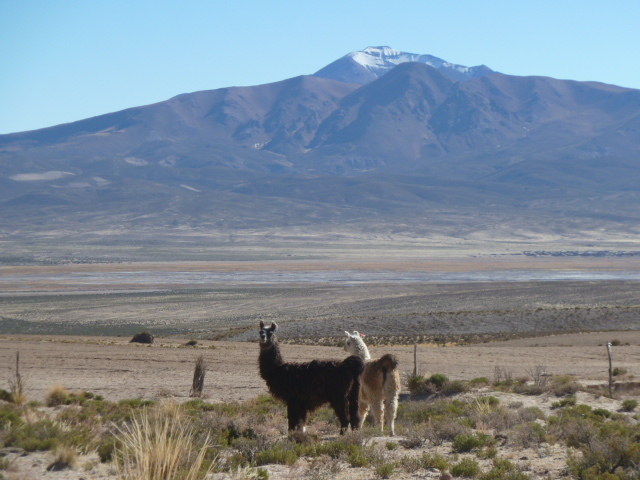
 |
| Bolivian icons - Volcano and llamas |
The next morning, we awoke just in time to see the sun appear over the mountains. In fact, despite it always being overcast in Chile during our visit, we were not to see another cloud for the next fortnight while in Bolivia! However, the stream outside had frozen overnight, reminding us of the altitude.
After some "huevos revueltos" (scrambled eggs - although the waitress may have understood my mime more easily than my Spanish...), we headed down the road again. Our destination that night was to be on the edge of a huge salt flat. But first, some more Altiplano scenery, more lagoons, and many more flamingos!
 |
| Near the Hotel de Flamencos! |
 |
| Jame's Flamingo - one of 3 species here. |
We also saw Andean and Chilean flamingos, which have different coloured legs, making it a bit easier to identify them!
Our driver, Ricardo, claimed to have driven in this area about 200 times, over 10 years. But this was the first time he'd seen flamingos in this particular lagoon. We were lucky. We had only diverted here to use the toilets at the Hotel de Flamencos, another very remote outpost.
Reluctantly leaving these lovely, leggy birds, we continued east, eventually coming to the main Bolivia-Chile railway line. Trains still run on this track, although I think passengers are rarely carried. If you want to know more about how the railways were built, mainly by British engineers and mining companies 100 years ago, I can recommend "Ghost Train through the Andes: a search for my grandfather", by Michael Jacobs. It's also an excellent insight into the culture of Bolivia and the fairly recent (up to 2005) political events.
 |
| The Chile-Bolivia main line. No manned level crossings here! |
After looking both ways to make sure no trains were coming, we drove alongside the railway for about 15 miles, across what we thought was a big salt flat. But we were to discover it was the size of an olive compared to the pizza-sized salt flat we would see tomorrow! We were staying at another San Pedro - San Pedro de Quemez (St Peter the "Burned", so-called after the village was torched by marauding Chileans. Neighbours, eh?!).
 |
| Identity tags for the llama |
The hotel was built of the plentiful local stone, which also provided the material for many corrals, full of llamas for the night.
On close inspection, many of the llamas had colourful knitted attachments round their head. These were to help identify the owners of the llamas, as they are mostly free-ranging. Luckily, they seemed peaceful and didn't demonstrate their famous habit of spitting.....
 |
| "For sale. One careful owner. Low mileage" |
After another hearty breakfast, now accompanied by coca tea to help alleviate the effects of altitude, we set off to the Salar de Uyuni - the biggest salt flats in the world. (Note that coca leaf tea is legal and healthy. Other derivatives of the coca plant might not be. I can't comment, not being a Coca-Cola addict!)
 |
| Petrified Cacti, Salar de Uyuni |
On the edge of the flats, a local had discovered some caves about 8 years ago. Excavating them himself, they contained a warren of ancient graves, full of mummified bodies in the foetal position. The air is extremely dry here, and there was very little decay. Even some cacti were fossilised. Some of the rocks were covered in what looked like coral. In fact, it was fossilised coral: still clinging to the rocks that used to be on the floor of the Pacific Ocean, now over 12,000 feet (3.8km) above sea level!
http://www.uyuni-bolivia.travel/salar-de-uyuni-guide
 |
| About half the size of Wales. Visible from space. |
Leaving the caves to their owner and his mummies, we headed north across the huge expanse of the Salar. (Spookily, my school Latin lessons of decades ago popped into my head as we drove across the endless white plain, and I was able to explain to our Bolivian hosts how salt had been so valuable in Roman times, that the soldiers were paid in it, hence our word "salary". They were dumbstruck by this factoid. Either that, or were concentrating on finding a landmark to navigate by).
 |
| Looking for the toilets... |
Soon, we left the surrounding hills behind, and had a 360 degree panorama - totally white up to the horizon, then totally blue above. The hard crust of salt, the remains of an ancient lake the size of Gambia, glistened like countless diamonds as it crunched under our tyres. We stopped to stretch our legs and taste the salt. Salty. Enough salt to keep all the fish and chips shops supplied for a million years. (Probably an underestimate. We will probably run out of fish long before we consume all the salt here.)
After about an hour's drive, some low hills - islands - appeared on the horizon. We stopped at one, Incahuasi, which was a nature reserve, holding many ancient cacti, as well as being a pre-Spanish sacred site.
 |
| The oldest and biggest cacti, about 900 years old. |
The local Aymara Indians (here long before the Spanish and the Incas arrived) have a legend which describes how the salt flat was created. All the characters are famous volcanoes in Bolivia. One volcano which dominates the Salar - Tunupa - took the form of a beautiful princess. Two gods / mountains fought over her, and after their armies reached stalemate, they engaged in single combat. The Great god, Illyama (a mountain that dominates La Paz), intervened and separated them; they shook hands, then Huayna stabbed Saraja in the back as he turned away. As he lay dying, Saraja swung his sling and fired his sharpest rock at Huayna. The rock hit so hard, it decapitated him. Miraculously, Sajara survived, and Tunupa had his baby. However, the child died at a few weeks old. Tunupa was grief-stricken, and her breast milk flowed unchecked - creating the vast white lake of Salar de Tunupa or Uyuni. (c. 4,000 square miles - slightly smaller than the Falkland Islands.)
 |
| Most bikers travel in convoy to avoid getting lost |
 |
| A salt crystal |
 |
| A local bus takes a shortcut across the flats |
 |
| Hexagonal patterns emerge, as the moisture evaporates.. |
 |
| Salt is collected by hand, then packed and distributed by local co-operatives. |
That night, we stayed at a hotel at the edge of the Salar. The only local building material is salt, and this is cut into large blocks to form the walls and floors. Smaller blocks are carved into tables and chairs. Only the toilets and showers are built of conventional, waterproof, materials!
 |
| Salt Hotel - table, chairs, floor, walls - all made of salt. Don't spill your soup here! |
 |
| Bedside table and walls - all made of salt. |
We've stayed at an Ice Hotel in Sweden, and this was almost as cold: just above freezing. Although the beds had electric blankets, we were now getting used to "dressing for dinner" - putting on some more layers!
 |
| Where steam trains come to die - Uyuni |
Next morning, after watching the sun illuminate the volcano, Tunupa, about 40 miles away across the salt flat, we travelled the short distance to the town of Uyuni, where we hope to see some decaying trains in the Train Cemetery.
 |
| Nice to see some well-travelled Manchester United fans have been here.... |
We had now crossed the massive salt flats - Salar de Uyuni - and were heading east. We would find more old trains, including one attacked by Butch Cassidy and the Sundance Kid; and one of the world's biggest silver mines. Not to mention, the remains of ancient civilisations and cities, the exploration of which left us breathless!
More soon.
Peter