If you've been following this blog, you'll know my wife and I moved to the Falkland Islands in January 2012. If you've not been following this blog, why not? :-)
Anyway, if you've just arrived you have some catching up to do, but this is probably the last posting, so no need to rush.
 |
| Darwin settlement with Mt Usborne in the distance |
In January 2017, I suffered a sudden retina detachment, my third in the 6 years here, and despite being rushed to an eye clinic in Oxford, it still takes a long time to travel 8,000 miles. A long time with not much to distract one. I was, and always will be, deeply grateful and appreciative for the treatment and care I received both in Stanley and Oxford, and for the Ministry of Defence flight to RAF Brize Norton which saved my sight.
 |
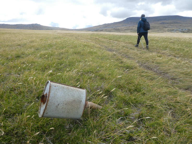
| Off road driving can damage your car. Mt Usborne |
But, it's not an experience I would wish to repeat, and so we decided reluctantly that when my wife's contract completed in 2018, we would not renew and stay on in the Falklands, despite our deep affection of the place and its people. When my detachment was diagnosed, I was put on a flight north, which luckily was leaving the next day. It arrived in Oxford the day after, and I was operated on within hours of landing. I simply don't believe I would be so lucky again.
 |
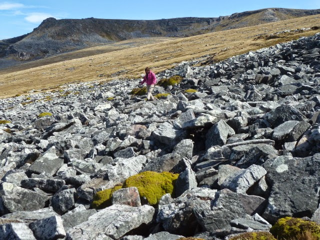
| Crossing stone runs can be tiring |
Before we leave later this month, we have a lot to do, but one thing we wanted to do was to visit various places on West Falklands.
 |
| Pet sheep, Darwin |
En route, we stopped at Darwin House, a favourite and very comfortable lodge about 60 miles from Stanley, and handy for the ferry, about 30 miles further.
 |
| Goose Green hare, ears down. |
We tried to walk up Mt Usborne, the highest hill in the Falklands. But after slogging up the slopes through the ankle-grabbing white grass, and knee-turning stone runs, the weather closed in and cloud shrouded the summit. So, so we trundled down the hill again. Better safe, than having to call out air-sea rescue teams.
 |
| Falkland Islanders are renowned for their re-cycling skills. Here a bus converts to bijou accommodation.... |
Darwin, named after Charles Darwin, who visited in 1833, is about a mile from Goose Green. Both were fought over in the first battle of the 1982 war. There are memorials to those killed from the Parachute regiment, including Col. H Jones VC, their Commanding Officer.
 |
| Goose Green |
There is also an Argentine military cemetery nearby, which received about 200 relatives of Argentine war dead on March 26. This event was widely covered by the media, as some 90 previously unidentified occupants of graves had recently been identified by DNA testing, and their relatives given the opportunity of seeing their relative's grave for the first time. Plaques saying "An Argentine soldier known only to God" were replaced with the soldiers' name.
 |
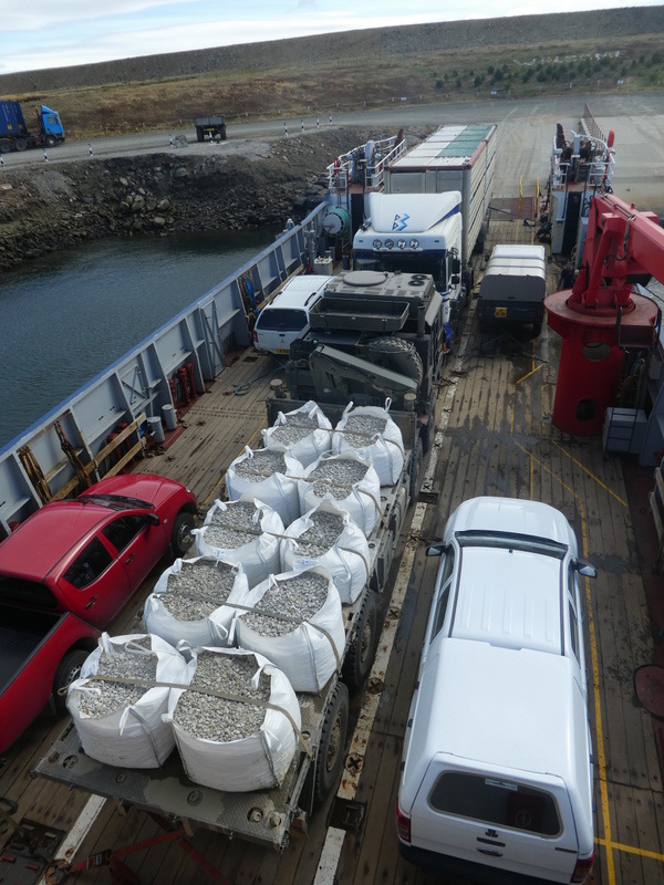
| Reversing the red car onto the ferry tested my manoeuvring skills! |
So, after fond farewells to the hospitable hosts of Darwin House, we headed for the ferry to West Falklands, along a road which is, apparently, outside the scope of the road traffic legislation, as are the roads of West Falklands. A strange feeling to know that a drunken, speeding, uninsured motorist could crash into me, and he wouldn't have broken any law! To suggest this needs to be sorted out is an understatement.
 |
| Possible Sei whale seen from the Concordia Bay ferry to East Falkland. Saw lots of "blows". |
Fortunately, we survived the roads and enjoyed a wildlife cruise on board the utilitarian ferry, Concordia Bay. We must have seen about 20 whales blowing during the 90 minutes crossing. There were also dozens of dolphins and seabirds.
 |
| Slight hollow gets us out of the wind while we have a picnic...Yes, that's a sheep skeleton. |
Our first stop on the West was Fox Bay West, closely followed by Fox Bay East. They are about 3 miles apart, but due to convoluted booking arrangements, we couldn't stay 2 consecutive nights in either. Not a problem as we received great accommodation in both and enjoyed the landscape and wildlife.
 |
| Fox Bay - We watched the dedicated Zimbabwean deminers working here. It shouldn't be long till the Falklands is mine free. |
We were soon continuing our trip on new, to us, roads. No traffic to speak of until I noticed 3 large trucks in my mirror, carting loads of stone for repairing the road we were about to dive along.
 |
| The road to Port Stephens. Looks empty.... |
Pulling over to let them pass, we slowly meandered south to the settlement of Port Stephens. The human population is about 4, although we had just missed a huge wedding with 99 guests. It must have been a wonderful, traditional occasion if the decorations in the shearing shed were anything to go by!
 |
| With about 50,000 acres to roam in, you'd think the sheep could find somewhere a little less annoying to congregate! |
The landscape around Port Stephens is hilly and coastal, so we were soon out and about following Land Rover tracks up the rounded hills. We didn't see many sheep, more Aberdeen Angus steers and penguins.
 |
| Curious cattle |
One day, we set out with a gale behind us to walk to Indian Village about 4 miles away across the bay. From a distance, the eroded rock protrusions vaguely resemble North American teepees. The walk was worth it to see those sculptures close up, but we still had to walk back into the teeth of a gale. Certainly, it blew away the cobwebs that day.
 |
| A good drying day! |
Also near the settlement is a large beach with thousands of penguins. They were mostly Gentoos, with a couple of King penguins mingling in their midst. There were also supposed to be Rockhopper penguins on the next beach, but as the walk entailed negotiating steep cliffs in a gale, and the birds may well have migrated away, we resisted finding those guys.
 |
| A couple of King Penguins mingle with the hundreds of Gentoos |
 |
| Wind-blasted rocks, Port Stephens |
 |
| Prime beef on the horizon |
 |
| Inquisitive Striated Caracara. Very rare and annoying raptor. |
The scenery was breathtaking, although we were disappointed not to quite make to it the spectacular headland of Calm Head. In taking an easy upward track out of the settlement, I hadn't realised that that meant a rather undulating route later on. So we opted for a distant view, and headed to the penguin beach, via some more amazing rock sculptures.
 |
| Calm Head(s) |
 |
| Looking south, from Indian Village (left) to Calm Head (right) |
 |
| Stephens Peak |
 |
| The Sphinx? |
 |
| Calm Head |
 |
| Tourists blocking the view... |
 |
| The beach has thousands of penguins already ashore and hundreds more at sea waiting to join them. |
Down at the beach, we noticed 3 people at the other end, so we settled down at "our" end to watch the penguins arriving home after a hard day's fishing.
 |
| Penguins porpoising purposefully, propelling themselves to safety. |
Within minutes, we noticed a patrolling sealion, who was obviously also waiting for returning penguins. He would come up for a breath every couple of minutes or so, but mostly he stayed in the shallows, and waited until the penguins were on top of him before attacking.
 |
| Bull sealion awaiting penguins |
 |
| The dark shape is Mr Sealion.... |
 |
| Landfall! |
 |
| Running for safety |
 |
| Acting nonchalant! Look BEHIND you! |
 |
| That's a penguin in the sealion's mouth, and I don't think it's getting mouth to mouth resuscitation... |
 |
| Petrels arrive for a piece of the penguin |
 |
| Hundreds arrive while the sealion is distracted |
All too soon, we had to leave the penguins and Port Stephens, and negotiate the roads....
 |
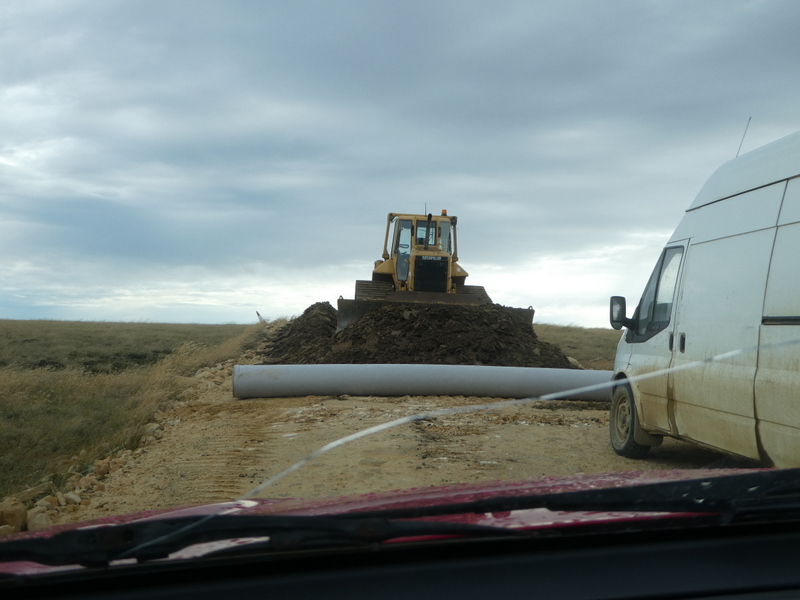
| Road repairs, West Falklands |
No need for contra-flow systems - simply drive off the road and around the blockage!
 |
| Commerson's dolphin while waiting for the ferry to East Falkland |
Waiting for the east-bound ferry at Port Howard we could watch the dolphins doing what dolphins do - feeding, mooching, acrobatics, etc
 |
| Dolphins enjoy company. |
 |
| Leaving the West |
 |
| Spot an albatross during the crossing. |
It was an exhilarating end to a wonderful trip. We hadn't covered many miles, but those we did were largely devoid of traffic or human habitation. Where settlements were found, we also enjoyed warm welcomes, not to mention teaberry buns. Thanks to everyone who has made this a special trip.
Adios. Sayonara. See ya. Adieu. Auf Weidersehen. Ciao. So long and thanks for all the fish. xx